This Negev hike is no easy climb, but once you reach the ridge you will see it was worth the effort. The only (real) trail that walks you along the Big creator edge. With a complete view across the crater and a hike along the Har Carbolet (Rooster’s Crown), you will come to understand the power of nature.
Har Carbolet & Nahal Mador
Negev Desert, Israel
Spring 2013
Map: Israel Trail Mark #15 (The middle Negev)
ratio 1:50,000
![]()
Trail: Har Carbolet & Nahal Mador
Har Carbolet follows the Israeli trail. Modifications have been made to the Israeli trail in recent years, so please, make sure your map is up to date!
Nahal Mador offers an easier path down the mountain, through the valley, and across the plain, but there are other options for creating a semi-loop trail. The most popular other option would be to continue with the Israeli trail towards Ofran river and descend from there. If you don’t have enough water or 4 more light hours, please chose the blue trail. Please check the end of this article and a map for further directions.
Seasons: These trails can be done year around, though fall and spring are highly recommended. Be aware of summer heat and winter rains, as the trail is dangerous in both.
Transportation: Two cars are required. It is recommended that they are 4 x 4. However, ours where not. Just make sure they are high enough off the ground that your under carriage will not be thrashed by rocks and sand. Somehow we did it with a Mazda 3 and another similar car.
If you are doing to do the Nahal Mador section of the trail, there is a place to leave your car where the blue trail intersects the dirt road. It might be hard to spot, but keep your eye open for the trail marker (if you reach the campsite, you have gone a few kilometers too far).
Our original plan was to create a longer loop, which is why we left the car at the campsite. Between heat and the fitness level of some people in our group, we had to re-route.
Sleeping: We arrived the evening before the trek and drove to the end, leaving one car at the Mador river camping site (where we would end the next day). We then parked the other car in front of the Oron phosphorus factory. There are no problems sleeping in front of the factory. They have plenty of wooden tables out in front and even recommended that we make a fire (which seemed to help with the mosquitos). The downside of the factory is that there is a bell that sounds at irregular times throughout the night.
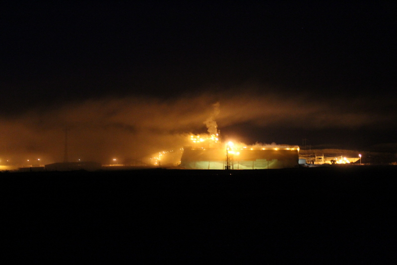
oron phosphorus factory at night
The trail:
Let’s start off with saying, bring plenty of water, wear good hiking shoes (no sandals, boots if you have them), and be at a good fitness level!
Our recommendation is to leave early in the morning, right before first light. This will allow you to safely get up to the ridge line without the heat of the sun.
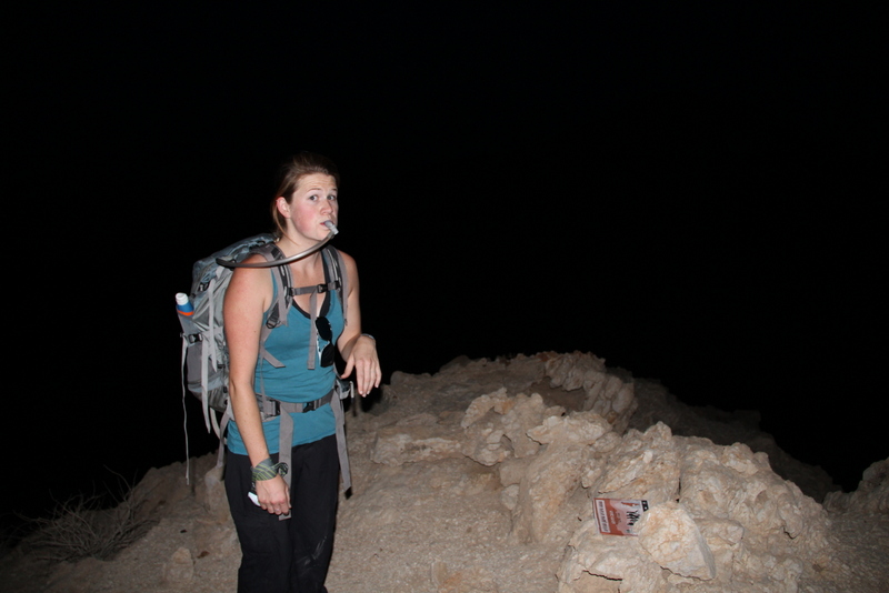
starting to walk before sunrise
If you start out from the factory, you will have to hike a few kilometers before you meet up with the Israeli trail. You will first hike through the factory gate, go straight along the dirt trail that circles the factory (when there is a split, stay to the left). Keep walking until you hit a half-paved-half-dirt road, take a slight right to join this road. You will cross railroad tracks immeditately. Keep following the road as it makes a left turn.
Stay on this road until you see a water pipe on the right side of the road. Next to the pipe there will be an obvious dirt road that heads east, towards the mountains. Take this road!
Warning, it will not be the first dirt road you see, as that leads to a pit they used to dig from. Do not take that road or you will end up hiking sideways along the mountain to the real road. We know because that is exactly what the four of us did.
Once on the trail, you will hike straight back until you meet up with the Israeli trail. It will be a small marker and may look like it means, continue straight. Don’t be fooled, you only continue straight for a few meters, before their is another sign on your lefthand side, indicating to climb up the hill to your left. If you continue straight on the trail and end up at a water tower, you have gone too far. Continue back down the road to the slight turn, and you should again see the Israeli trail marker.
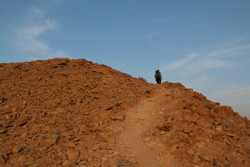
let the climb begin
Take a left to the Israeli trail and begin your climb. There are about three sections to this climb. The rocks are sharp and the trail is uneasy, so make sure your footwear is appropriate. Once at the top, you will be able to see across the Big (Great/Large) makhtesh (also known as crater, though it really is not one), offering staggering views. Please note the many colors, representing the diverse minerals and rocks, along with the stratification.

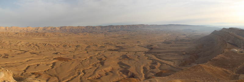
Big Creator panorama
As you continue along the ridge, you will come to many slanted parts. Cross carefully and always remember where the edge is. The ridge will continue to develop and change in the light of day. Keep an eye out for any ibex that may be enjoying their morning climb.

walking on the edge
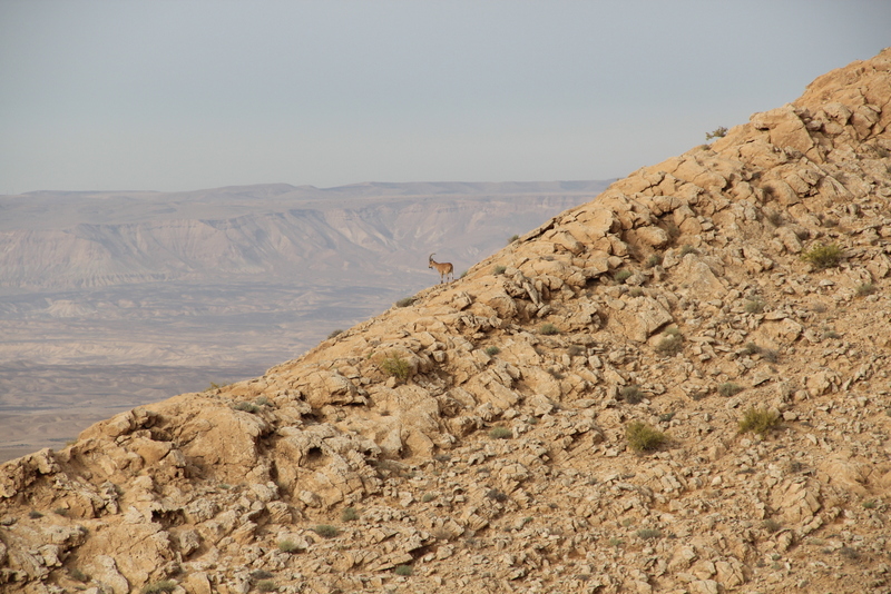
Nubian ibex
There will be two descents (each of which will be followed by an assent) before you reach the final decent to the blue trail. Use the descents as your resting areas, if possible, as they offer the most shade. The blue trail will take your through Nahal Mador, the valley leads out onto the desert plains.

Big Creator panorama
Keep an eye out for any gekkos that might be hiding in the shade, along with the array of desert birds.

chilling in the shade
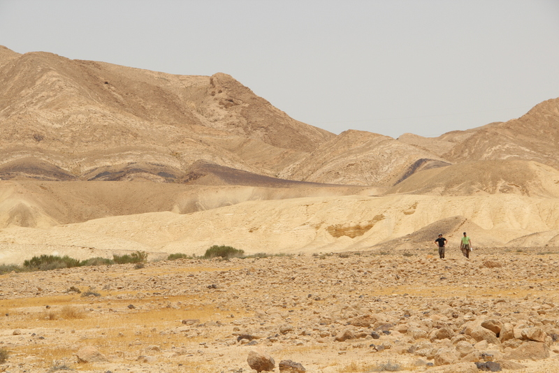
Once you have reached the plains/open area, you will have an easy walk back to the main road, just keep following the blue signs. The signs will hop from the left to right and back to your left side, etc.. So, keep open eyes. The hardest part about this ending will be the heat. There is absolutely no shade during this section and no protection from the sun. Keep your hat on, re-apply sunscreen as necessary, and keep drinking your water!

walking along the blue trail, back to the main toad
(The other option is to not take the blue trail. Only proceed with this option if you have enough water and at least 4 hours of sunlight left.
Continue along the ridge following the Israeli trail until the Mador River camping area. This offers you a longer trek along the ridge, though the most beautiful views are suppose to be before the blue trail turnoff. This option is approximately the same length, but harder since you remain climbing along the ridge and the decent along the Ofran river path is tricky.
This was our original plan, before we had to re-calculate based on the fitness level of some members off our group. Both options are possible and offer staggering views of the Big makhtesh. Do whatever works best for your group.)
