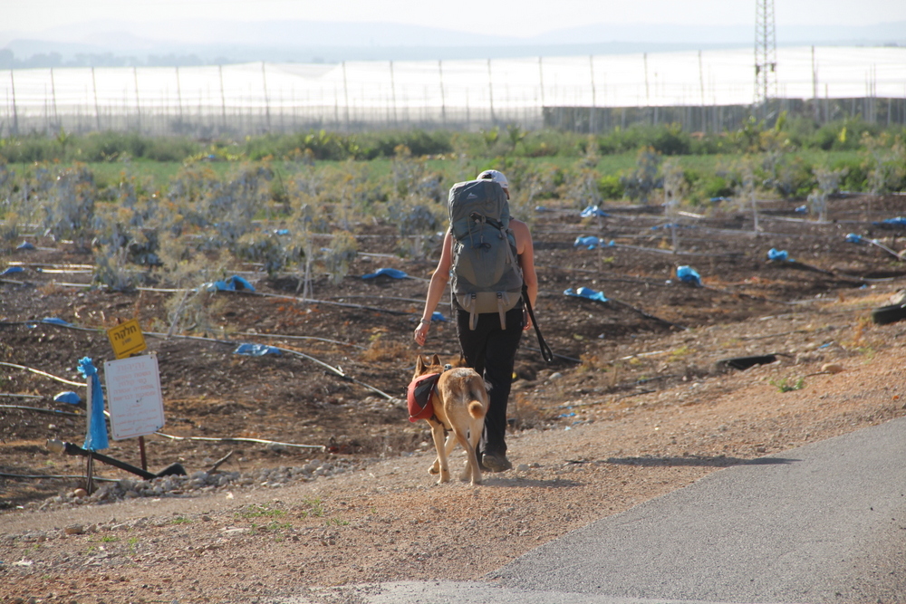
A 3 to 4 day trek from the Mediterranean Sea to the Kinneret (Sea of Galili), across northern Israel. The whole journey lasts 75-80 km. There are several options to divide the trail to days, but we recommend to be in shape before leaving for the trail due to the long distance that should be walked every day, and the different terrains.
Google Map of Trail Points and descriptions
Map: Israel Hiking Map #2 scale: 1:50000 and super accurate! (but always check for trail updates, as they happen fairly often) cost around 100 sheks at any local camping store
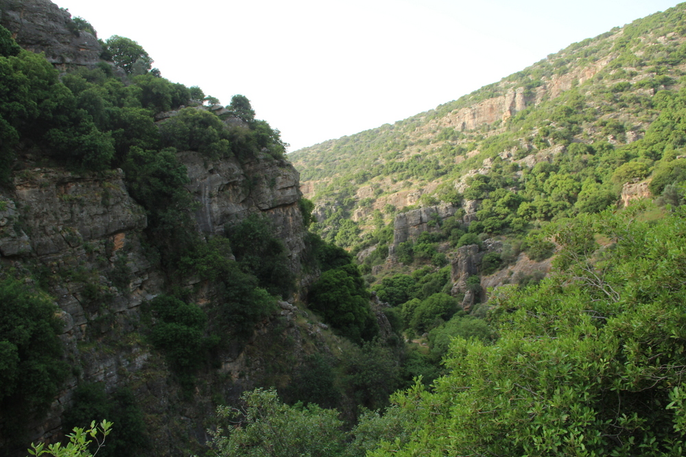
This beautiful terrain is best treked during springtime, after the rains but while it is still green. Watch out, the trail will be packed over the Peseach (Passover) holiday. However, starting the trail on Wednesday or Thursday can eliminate a little bit of the crowd during this time.
Option A: 4 Day Trek Plan
- Day 1 – from Akhziv beach, through Khziv river to Abirim
- Day 2 – from Abirim, through Elkush bridge to Hirbet Hamama (Camping site in front of Mount Meron field school).
- Day 3 – from Hirbet Hamama, though Mount Meron peak and Upper Amud river, until Ein Koves (on that option, you have to reach to Sechvi pools until 1PM in order that the rangers will let you pass on until Ein Koves. Otherwise, you can climb from Sechvi pools to Zefat and from there to reach Ein Koves)
- Day 4 – from Ein Koves, through central Amud river until the Kinneret
Option B: 3 Day Trek Plan (for fast walkers)
- Day 1 – from Akhziv beach, through Khziv river to Abirim
- Day 2 – from Abirim, through Elkush bridge and Mount Meron peak to Henyon HaPitul (Pitul parking lot)
- Day 3 – from Henyon HaPitul to the Kinneret
Arriving to the Start
In order to start the first day early there are two options:
- Camp the previous night on Akhziv beach
- Catch an early train (leaves from Tel-Aviv Alrozorov station only during the night) to Nahariya.
Local tradition is to carry a bottle of sea water from the Mediteranean and pour it into the Kinnerert at the trails end. Yes, it is a little extra weight but worth the good luck brought on. Be careful not to drink the bottle by accident!
Day 1: from Akhziv beach, through Khziv river to Abirim
Pay attention to the fact that the first part of this trek (from the Mediteranean Sea until the dirt road that leads to the enterance of Khziv river nature resort) has no trail mark on the map.
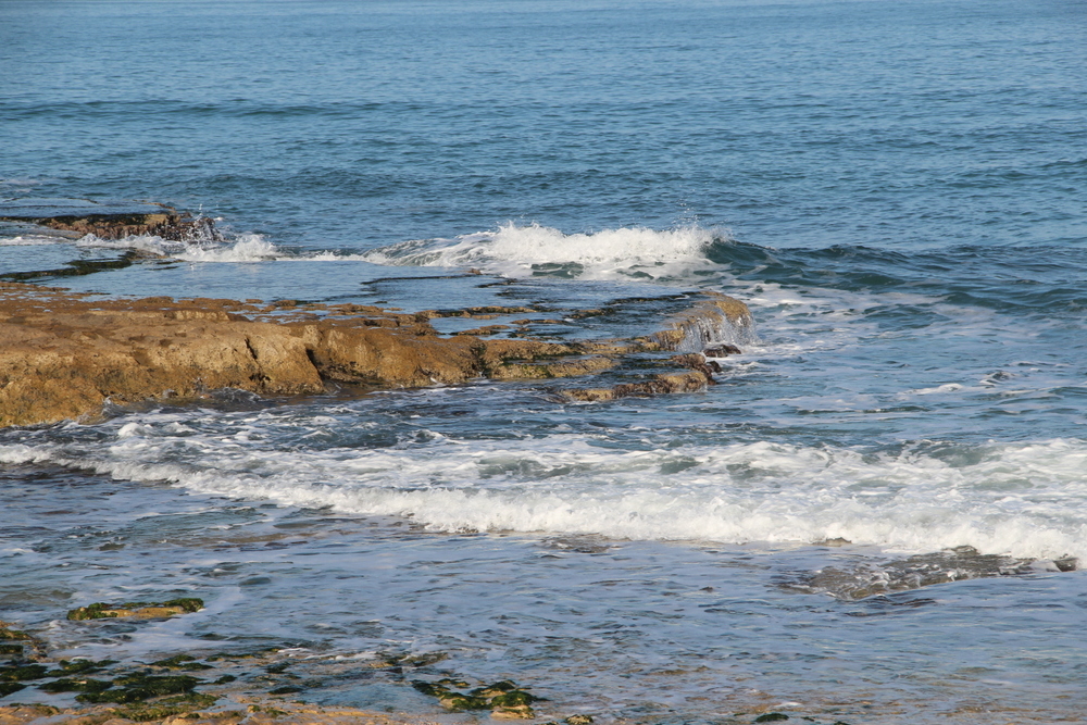
After filling your empty bottle water from the Mediterranean Sea (a tradition), walk east with Khziv river stream under the bridge on the southband side. Once across the bridge you will reach a dirt road that goes on the outskirt of an agricultural area. Follow this road east (always on the southern side of the river), until you reach road 70 (about 5 Km).
The History of Achziv: Only 15 minutes north of the historic port of Akko, Achziv has a rich and interesting history. It was meantioned in rabbinical text and is known to be a Phonecian city controlled by the tribe Asher. The city was added to the territory of Kind David, only to be given back to Hiram by King Soloman. The city has seen Assyrian rule, was renamed Casle Umberti during the Crusades, became an Arab village during the Mamluk and Ottoman periods, had its residents flee to Lebanon during the 1984 Arab-Israeli War, only to be turned into the most renound micronation and nudest beaches, within Israeli, in the 1970’s. This city has seen war, raiders, resistance movements, and finally, the lovely bodies of Israeli’s finest filmstars skinny-dipping on its beautiful beach.
The History of Khziv Bridge: On the nights of 16th and 17th of June 1946, the Haganah implemented Operation Markolet (also known as Night of the Bridges). Their goal was to destroy eleven bridges that linked the British Mandate of Palestine to the surrounding countries of Lebanon, Syria, Jordan, and Egypt. Throughout the night, the Haganah carried out approximately 50 operations and ambushes in the hopes to disguide the primary operation from the British Army. The only failure within Operation Markolet took place at the Nahal Akhziv bridges were fourteen Palmach members were killed and another five injured. All the other operations were carried out successfully.
Upon reaching road 70 make a left hand turn (to the north) and walk a few meters, only to turn right (east) towards road 8911 — leading to Avdon. A few hundred meters after the turn you will reach a fork. Stick to the left road (towards Avdon) for another 1.5 Km. Keep your eyes open for a dirt road, marked with a green trail mark, that splits from the paved road you are walking on. Follow the green trail mark until you see a water pump station – this is the entrance to Khziv River Nature Reserve.
Keep following the green mark which will take you back-and-forth across the river. After 5 Km there will be a side trail to the Montfort Castle (a red marked trail with a steep climb, but this 1.5 Km there-and-back trail is well worth the extra trek if time allows). From the split, you have another 3 Km walk till Ein Tamir (Tamir Spring) – a relatively large spring.
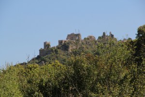
Montfort Castle: This spur castle was built during the Middle Ages during the Crusades. It orginally was built by the French and then sold to the GermanTeutonic Knights, at which time its name was changed to Starkenberg (Meaning: strong fort, the same meaning of its orginal french name.). Unlike most crusade castles, it was built orginally for use as an agricultural land. When the land was passed into German hands, with assistance from the Pope and European contributions, it was established as one of the most well-fortified castles, sitting on its cliff above the river. The keep that they built at the heart of the castle are the primary remnants seen when visited today. The Mamluk and Baibars attempted to seige the castle in 1266 but failed. After gaining control of more land and resources within the Nahal Valley, a second seige took place. At the end of seven days the Teutonic Knights surrendered to the Mamluk and returned to Acre, where they staid until its fall in1921.
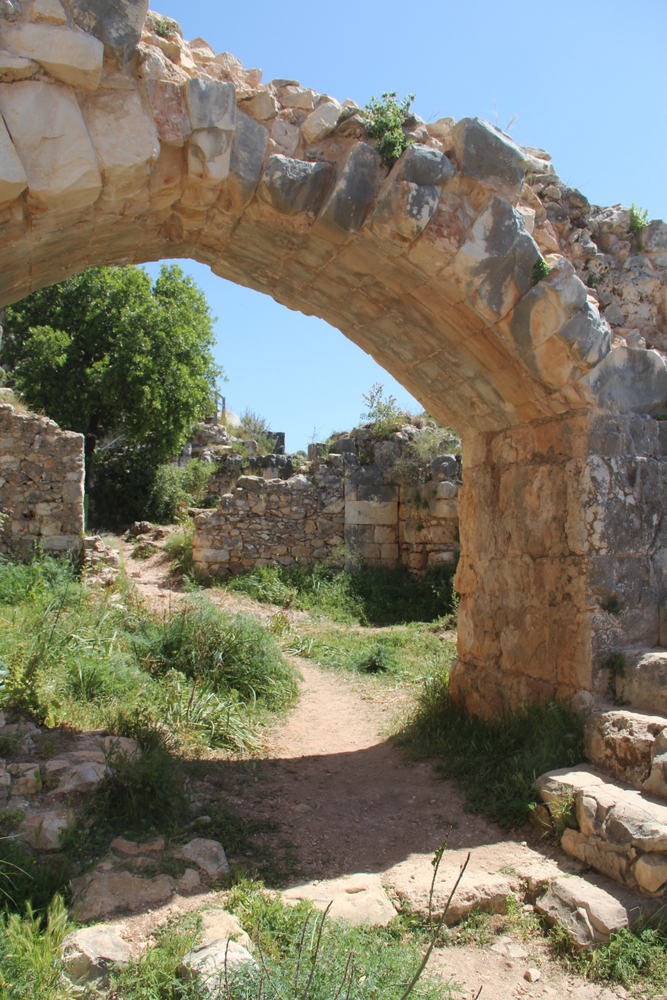
Continue for another 2 Km and then turn left, following the black trail marks, climbing your way towards the road which leads to Abirim (about 600m from the village gate). Sleeping in the village is allowed, however request permission from the locals and follow their instructions as to where the designated areas are (be sure not to disrupt theirpeaceful oasis) or camp outside the gate.
Abirim is where you should fill your water bottles for the next day. You can use the water tap located next to the basketball court.
Day 2: from Abirim, through Elkush bridge and Mount Meron peak to Henyon HaPitul (Pitul parking lot)
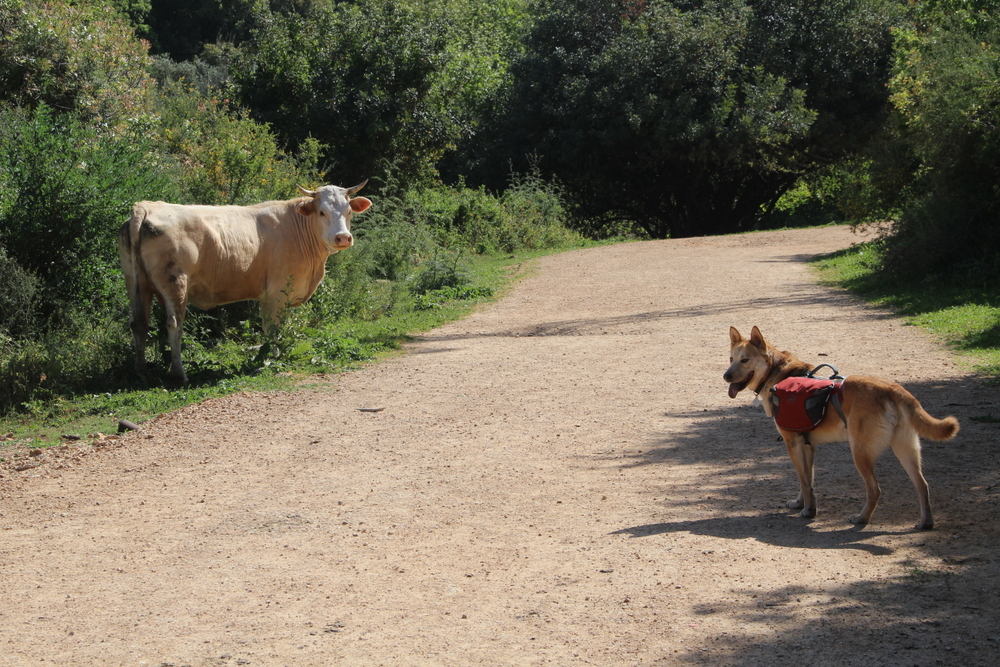
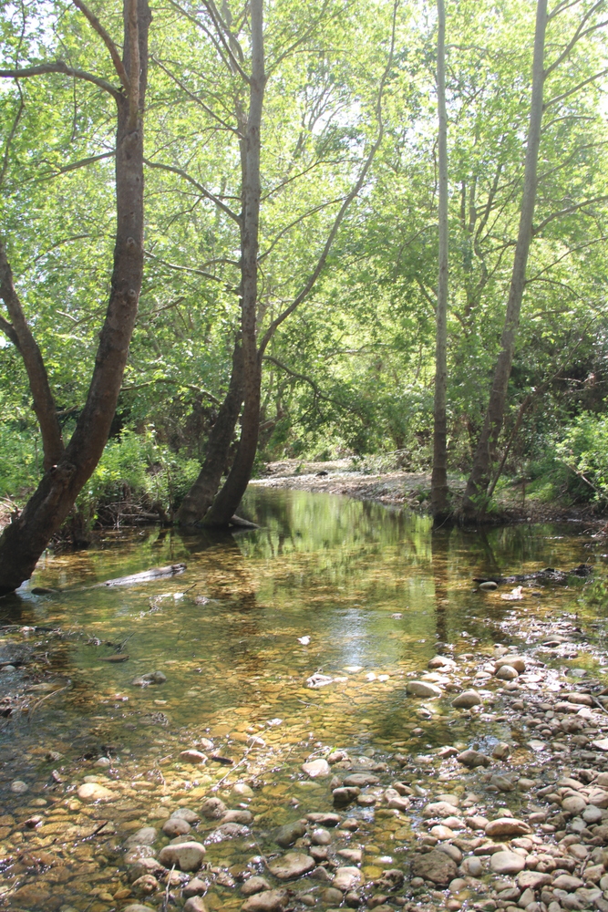
Trail markings will be confusing at the beginning of the day. They are unclear and/or not well marked, but they do exist. Keep your eyes open and pay attention (We also added general information about the terrain. Hope this helps a little! ). Walk down the paved road — away from Abirim. Continue a few meters past the point you hit the previous day, then turn left onto a dirt road with red trail markers. The road leads you downhill. When you reach the bottom, take a right turn onto a green trail. Be aware that this green mark does not exist on all maps (It depends on its last update date. We had a map from 2007 and needed to add it manualy). The green trail starts by taking you through a wide cow pasture that belongs to Fassuta village. Continue following the green trail marks. You will cross a gate, the trail changes to a dirt road (still green trail mark) that meanders through the village’s agricultural areas and seasonal pools until it hits a paved road. Keep following the green mark, making a right hand turn onto the paved road. Shortly followed by a left hand turn (only a few meters) onto a dirt road (yes — still following the green trail mark). Continue going down towards Zavit stream, from there up to Hirbet Morgot, and down again towards Elkosh bridge.
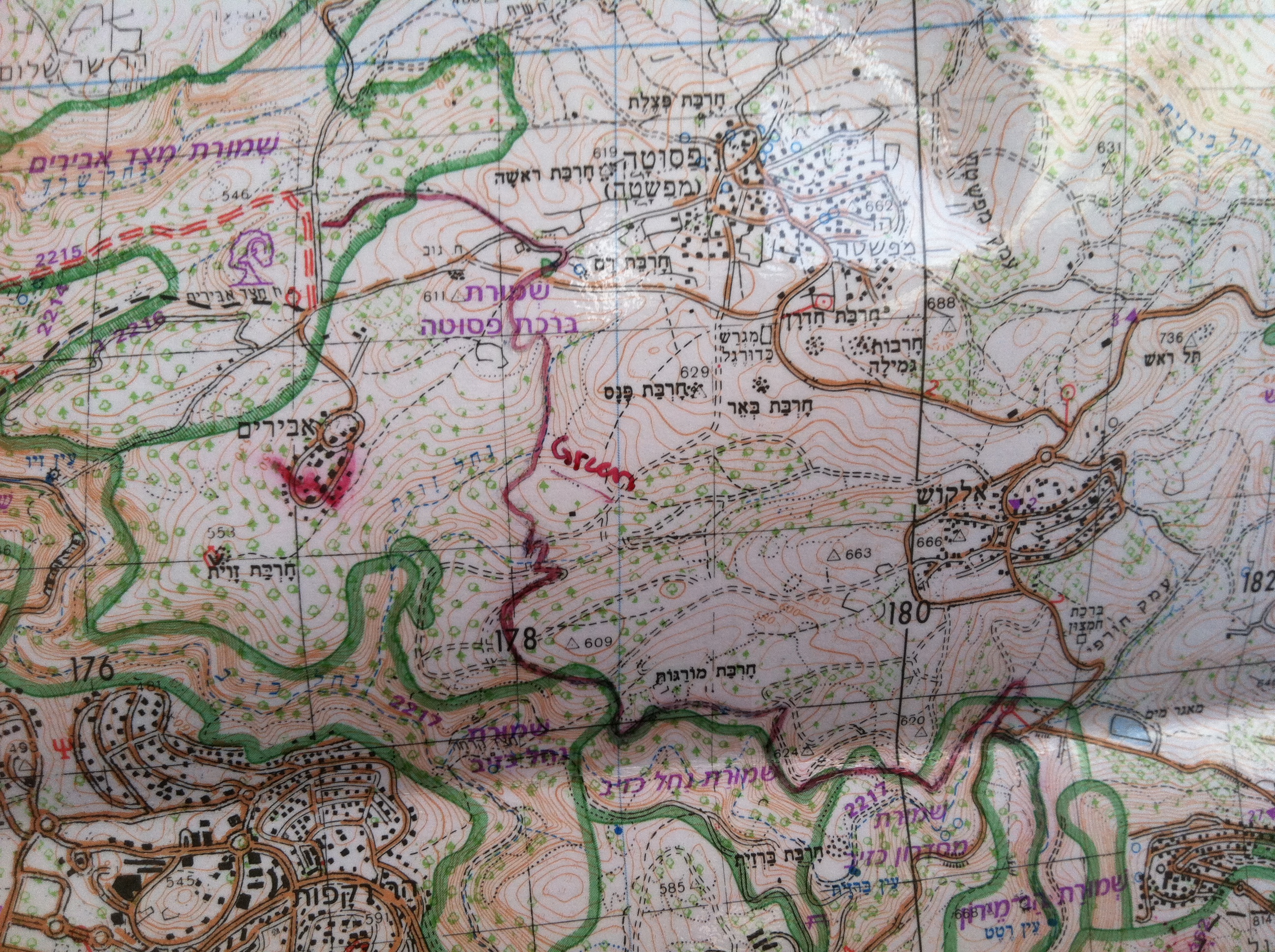
Referance: The new green trail (Sara drew it onto our map… in red)
Before continuing under the bridge, it is possible to walk 500 meters on the paved road towards Horfish, and stop at the gas station to refill your water and a get cold snack. Under the bridge be aware not to step in the sewage stream. Stick to the green trail mark that takes you back to Khziv river – this time its the upper part.
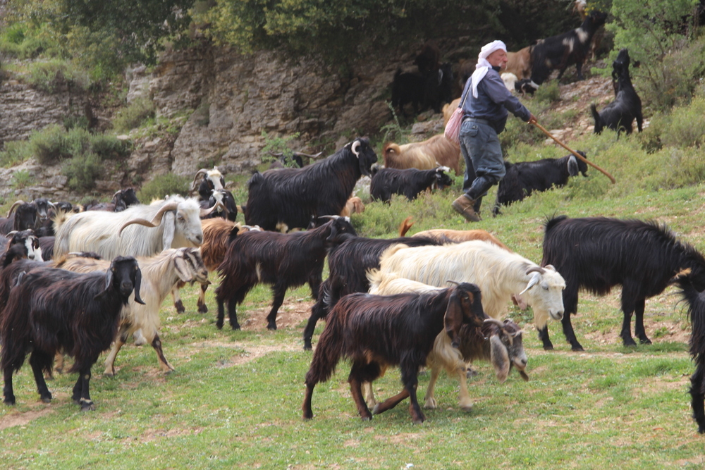
Along this part of the river you will notice several springs (once has more water that the others) and probably a shepherd with his goats. The main and last spring is named Ein Hotem. It’s a pretty place to stop for a break, though it is commonly packed with locals from the Druze city of Hurfeish.
2 Km after Ein Hotem the green mark will hit a dirt road labeled with a black trail mark. Cross the road (remaining on the green trail) and start climbing to tonight camping spot at Hirbet Hamama in front of the Mount Meron field school. You can climb your way up walking through Moran River or Neriya River. For the first option just stick to the green marked trail, for the other option follow the red trail markers which splits from the green 400 meters after crossing the dirt road.
Find your spot and fill your water bottles. During the off season the place will be quite vacant of travelers.
Day 3 – from Hirbet Hamama, though Mount Meron peak and Upper Amud river, until Ein Koves
The third day starts with a climb to Mount Meron Peak – the second highest peak in Israel, and the highest point of the reail. To reach there, from the camping area, take the black marked trail which merges with the Across Israel trail (marked with orange-blue-white stripes). From now until almost the end of the Yam el Yam trail you will stay on the Across Israel Trail. The trail commonly merges with other trail markers, so we will provide you with the additional color trail marker information. Just before the summit you will hit a red marked trail; the summit trail which circles Mount Meron summit. Take a left turn on the red trail and you will have beautiful views to the North of the mountain. On a good day it is possible to see all the way to Mount Hermon, on a bad day you will have fog.
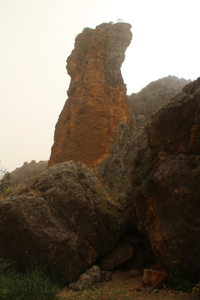
From the summit follow the Israeli trail mark. You will cross a small paved road and merge with a blue trail only to turn to a green trail 400 meters later. On the green trail you will pass several Hotas. Hota – means whale in Arabic – is a cave that forms after rain water carves away the limestone from within, until it’s roof collapsed. Some of them are protected by railings, and some are not, so please stick to the trail. After 2 Km from where the green mark started, the Across Israel trail mark splits from it. Stay on the Across Israel trail which will take you through the pretty Ein Zeved spring and a big rock in a shape of a chair that is named Eliyaho (Elijah) chair, until you hit a camping/parking site named Henyon HaPitul (Pitul parking lot). There you can take a break and fill your water.
From the parking lot you will continue along the black trail. It starts by walking through a tunnel under the highway, and continues with a nice trail next to Meron River. After 2.5 Km you will reach the entrance to Amud River Nature Reservation (be aware that you might get charged an entrance fee along the trail). Amud River streams perennially and spills into the Kinnert (the Sea of Galilee). In 1925 during an excavation that was made in the caves along the river they found a human skull, that was belived to be the first evidence of the Homo Niandertal in Asia. Later research claims that it is actually a later Homo Eraktos or an early version of the Homo Sapiense.
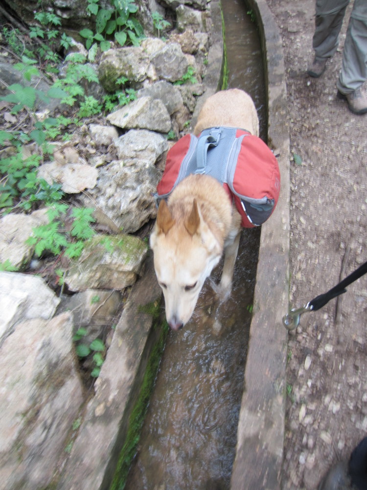
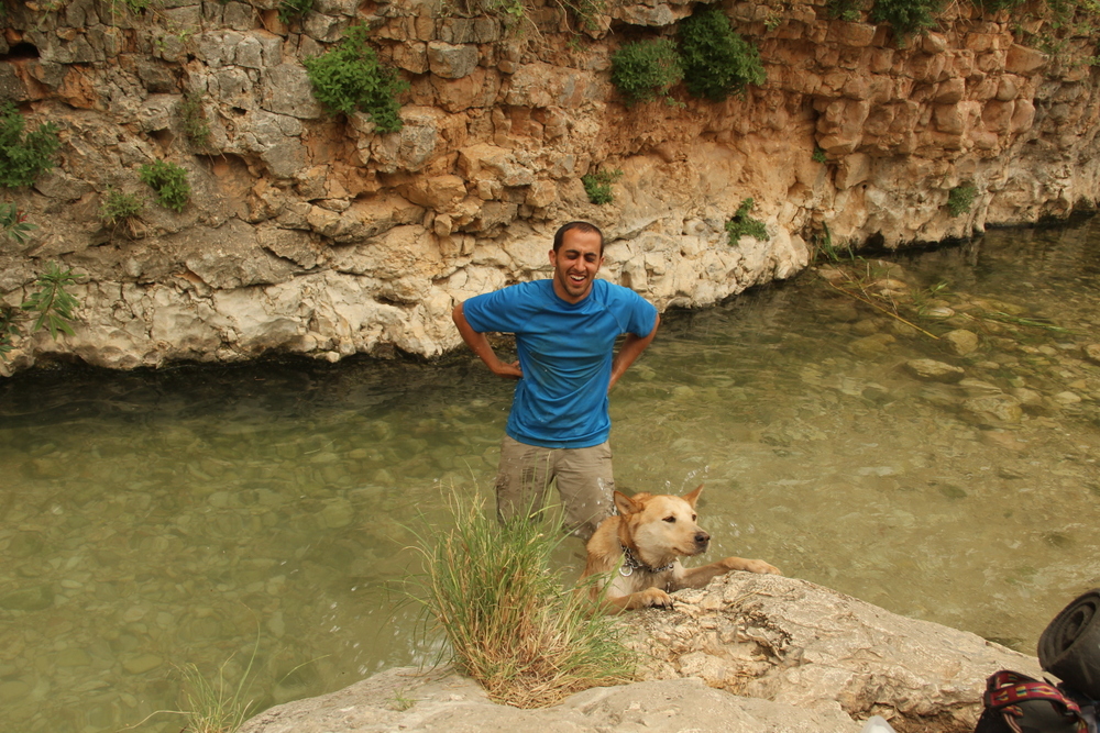
The first spring you will come to is Ein Yakim. Next to it you will find an aquaduct that leads water towards a flour mill, fulling mill, and agriculture. Walking inside the aqueduct was by far our dog’s happiest moment along the trail! After another 1Km you will reach Sechvi pools, where you can fill water in case needed, but make sure to treat it before drinking.
In order to keep walking on the black trail towards the night’s camping site, Ein Koves (Koves spring), make sure you reach Sechvi pools by 1PM in order that the rangers will let you pass (They might let you pass also a little bit later (sometimes until 2PM) as long as you tell them you’re only heading towards Ein Koves). If you managed to pass the rangers, keep walking next to the river, on the black trail mark, for another 2.5 Kms, before turning left to a blue trail mark that will take you all the way up towards Ein Koves. The blue trail is a 500m walk but also the steepest climb you will do during that trail. Make sure you leave the reservation area before you set up camp.
If you arrive too late to Sechvi Pools and the rangers will not let you pass, you will need to climb to Safed (צפת) and from there walk to Ein Koves. To do that, take the green trail 600 meters and then make a right turn to the blue trail for another 600 meters until you reach a road. Make a right turn and walk along the road. On the junction make another right turn and then the second left turn until you come to a blue marked trail/road that is also accessible to cars. This road will take you all the way to Ein Koves after almost 2Km.
In Ein Koves you can camp either next to the spring or at the forest closer to the blue trail that climbes from Amud river.
Water in Ein Koves – that might be the trickiest place regarding water in that hike. One option is to treat water from the spring next to the camping or from Amud river. Another option, especially if you walk through Safed, is to get water from there (the closest gas station is about 1.5 Km from the campgrounds). Depends on your luck, you might get a ride from the spring to the city. From our experience we recommend not to count on it, and treat enough water for the night and for the 4th day.
Day 4 – from Ein Koves, through central Amud river until the Kinneret
Make sure you leave early (preferably on sunrise) since unlike the previous day, most of it the trail is not shaded. Also make sure you leave with enough water since there are very limited options to fill water on that day.
First you need to get back to Amud River along the black trail you hiked yesterday. To do that return through the steep blue trail you climbed yesterday, and turn left once you hit the black trail. The river is rocky and you walk along a cliff so watch your step carefully.
After almost 1.5 Km you will reach a split with a blue trail that climbs to the “Seas Lookout” – from there you are able to see (on a good day) both the Mediterranean Sea and the Sea of Galilee. A round trip to the viewpoint and back is about 3 Km. It is not part of the trail but if you feel really in shape and left early in the morning – go for it.
You should keep follow the black trail mark for another 5 Km until you reach a parking lot next to road 85. 500 meters before the road pay attention that the black trail mark turns left on a dirt road. On that spot check that you have enough water to continue. We didn’t have so we had to wait for 30 minutes and asked random nice people for a ride to the closest gas station (3.5 Km one way).
The black trail continues from the path located next to the gate at the entrance to the parking lot. The trail continues under the highway. 3.5 Km after, you will pass next to a siphon. This is an engineering project that uses the concept of communicating vessels in order to pass water through the river valley without the need of pumps. This stream of water flows from the Kinneret; transporting water through the national water carrier.
1.7 Km later you will reach a pole which the river is named after; Amud (עמוד) is the Hebrew term for pole. At this point a pretty and surprising spring will wait for you between winter to spring time. It is a great and unique spot for a quick shower. 300 meters after you will hit Road 8077.
After crossing the road you go back onto a dirt road (still following the black trail/Across-Israel trail markers) for another 1 Km until the black trail mark splits from the cross-Israel trail mark next to agricultural fields. From here you have several options to finish the trail at one of the Kinneret beaches.
The shortest option will be to follow the black trail mark next to Amud river, which takes you under a bridge on Road 90 and then continues through fields for 2Km until you reach a non-declared beach next to a fish farm. The downside of this option is that after the rains of 2012 and 2013, the water is not accessible due to reeds, and is impossible to swim. We took this option cause we wanted to get to the Kinneret ASAP due to some injuries and the late hour we arrived at. It was an unexpected anti-climatic place to end — to say the least.
Beach option #1 – After the bridge under road 90 from the previous option, keep walking north next to road 90 for another 1Km. Then turn right onto a dirt road that leads to Amud beach in Karei Deshe after 500 meters.
Beach option #2 – Instead of taking the black trail, keep walking on the Across-Israeli trail for another 1.5 Km then turn left onto the blue trail. Continue for another 1 km until you intersect with Road 90 at the entrance to Ginosar. From there, it is a 500 meters walk to the beach.
Beach option #3 – Instead of taking the blue trail mark from the previous option, keep walking to the Across-Israel trail for another 2 Km until you intersect with a road that leads to Migdal. Turn left on that road and cross Road 90 on your way to the Kinneret (another 500 meters).
Wherever you decide to finish, remember to spill the bottle of sea water that you have been carrying since day 1 into the Kinneret. After all, it would be a shame to carry all that possible good luck only to forget about it!
You can call a taxi cab from Tiberias (Tveria), or take a bus if you end up next to Karei Deshe, Ginosar or Migdal (check days and hours before you leave). They will take you to Tveira central bus station, and from there you can take a bus back home.

Pingback: Capturing the Moments – Yam el Yam | Grab the Backpacks·
Pingback: Yam l’Yam (Sea to Sea) – Day 3, Har Meron to Abirim | Temporary Travels·
Pingback: Yam el Yam (Sea to Sea): Pre-Departure | Longing for a City·
Pingback: Yam El Yam (Sea to Sea): Day 1 | Longing for a City·
This is the best site about Yam l’yam. Without those informations, we couldn’t do the trip. Congratulations and thanks.
The best web site for Yam Le Yam. Very well explained and easy to follow. Amazing